“I didn’t think anyone went to Siberia willingly,” a friend replied when I told him I was going there with the Polaris Project. Gulags are the first images evoked by the name, and, for most of us, the last. Siberia seems an abstraction: of coldness, of a place beyond all other places, of utter remove from the world. (Soviet prisoners condemned to the terrible gold mines in the Kolyma River region, where the Polaris Project is heading, called it “The Planet.”) But look at the map; look at the size of Siberia. It’s surely the largest chunk of world geography about which we know almost nothing. It may be obscure, but it can’t be that simple, a giant penal colony. Yet even the name is slippery. “Siberia” appears on no official map. Just what is this Siberia?
Let’s start with size. Running north-to-south from the Kara Sea to Kazakhstan, the Ural Mountains separate Europe form Asia. Likewise, they separate “European Russia,” including Moscow and the other major cities, from Siberia. Siberia then sprawls east all the way to the Pacific Ocean—some 3,000 miles, across eight time zones, fully one-twelfth of Earth’s surface. Larger than the contiguous United States and most of Europe combined, its sheer land area defies comprehension.
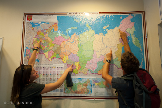
From Moscow to Cherskiy
Siberia is bordered in the south by Kazakhstan, Mongolia, and China. This southern sliver of Siberia, on the Eurasian Steppe, is relatively well populated. A string of towns with barely pronounceable names hugs the tracks of the Trans-Siberian Railway, which originates in Moscow and ends at Vladivostok on the Sea of Japan. But this, the rolling grasslands of the steppes, is not the Siberia of popular imagination and nowhere near our destination. That Siberia lies north and east, and judging from the map, everything changes north of the tracks. I see no towns, no roads. Therefore, the great Siberian rivers, the Ob, Yenisei, or Lena, might afford the best route north. They all flow that way. As the traveler drifts northward on any of these rivers, he would soon see the steppes give way to the world’s largest forest, the taiga, which stretches across the entire width of Siberia and north to near the Arctic Circle. Beyond the Arctic Circle, the climate prohibits trees, and a new environment, the tundra, takes over. Both the taiga and the tundra ride atop permafrost, which in some places is 1,500 meters deep.
Up here, almost nothing of man’s modern hand interrupts the patterns of nature. This is so because the continental climate is inhuman in its extremes, and because permafrost, with it annual cycles of freeze and thaw, does not welcome man’s structures. But here at the irregular southern fringe of the tundra, the traveler has still not reached the top of Siberia. There are many hundreds of kilometers of lakes and streams, and bogs still to cross before, finally, the traveler reaches the shore-fast ice at the edge of the Arctic Ocean.
So given the size and ecological diversity, it made little sense for me to tell my friend I was going to “Siberia.” I should have said we were heading to a region of northeast Siberia called Yakutia, to an isolated science station on the banks of the Kolyma River. And I would have done so except that at the time I had never heard of Yakutia or the Kolyma River, not until our Chief Scientist, Max Holmes, pointed to them on a wall map in his office at the Woods Hole Research Center.
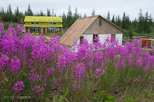
Lab buildings at the Northeast Science Station
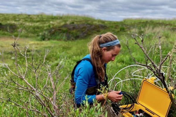
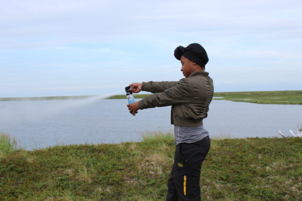
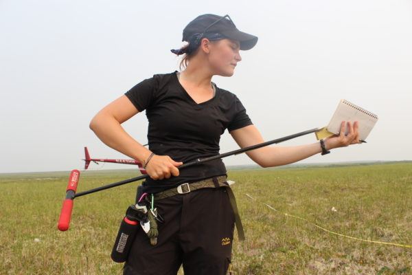
On July 1st, twenty-two of us, including fourteen undergraduate scientists from American, Norwegian, and Russian colleges, several faculty, and a writer will travel to Moscow. After a jet-lagged tour of the city sights, we’ll fly six hours east to Yakutsk, thence north several hundred miles to the Northeast Science Station, run by Sergey Zimov, about whom we’ll hear much more. I’ll go along (quite willingly); I’m the writer. I’ll post to the Polaris Project website daily essays about the science, the environment, and of course the young scientists who will have the privilege of living for a month (aboard a river barge) deep in the very environment they seek scientifically to understand.
The project’s central scientific objective is to understand the carbon cycle. We’ll delve more deeply in the weeks to come, but for now let’s describe the carbon cycle as the biogeochemical exchange of carbon among plants, soil, the atmosphere, freshwater lakes, streams, rivers, and the oceans. The student scientists will devise the means and pursue projects to measure arcs of the cycle as reflected in lakes, in the river and its tributaries, on land, and in the local biodiversity. And when they return home, the students will present their findings and their personal experiences to their peers and the public in various venues. The project’s secondary objectives are to engage students in Arctic research and, equally valuable, to spread the word about the Arctic.
There are no happy words coming out of the Arctic. The famous and outspoken climate scientist Mark Serreze put it baldly: “The Arctic is screaming.” The climate has already changed in the Arctic. What that means for the future of the Arctic environment—and for the rest of us—remains to be seen, and perhaps will be revealed by the next generation of scientists, one or two of whom might have been inspired by Polaris Project fieldwork. To study the carbon cycle in the Arctic is to study climate and climate change. However, what I’d like to call the Arctic emergency only generally answers the reasonable question, why travel halfway around the world to study carbon? Isn’t carbon everywhere?
It is, and the carbon budget is global in scope. The Kolyma River watershed, however, is especially important for Earth’s climate future. Unlike most of the rest of the Arctic, this region remained un-glaciated during the last ice age, which is to say that the Pleistocene Ice Sheet did not scour away the soil and everything else down to the very bedrock. Here, as a result, the permafrost is extraordinarily deep. When trees and plants die on the surface of the land, bacteria go to work on them, and the byproduct of the resulting decomposition is carbon dioxide (CO2). When similar bacterial decomposition occurs beneath the surface, without oxygen, the result is methane (CH4). Methane is a greenhouse gas twenty-one times more powerful than CO2. As long as the permafrost remains frozen, the atmosphere is safe from the methane. However, there are sound indications that the permafrost is thawing. The Kolyma River watershed is a potential climate bomb.
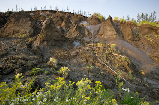
Permafrost oozes into the Kolyma River at Duvannyi Yar
I’ve been reading some Russian history and books about Siberia by good travel writers. I’ve studied maps, looked at fine photographs by Chris Linder from previous iterations of the Polaris Project, and read a bevy of technical papers. I’ve seen a little of the tundra environment on Alaska’s North Slope. But I was there to meet a research vessel. The Polaris Project is different. We’ll be immersed for a month in the environment. I don’t know what to expect, but I’m probably not alone among the expectant participants to think of the coming field science in the language of adventure. And we hope you’ll join us as a vicarious participant. We’ll travel by boat to the complex delta at the mouth of the Kolyma, where last year a sudden slashing storm forced Polaris Project people to shelter overnight in a rickety fisherman’s cabin. We’ll head upriver for Duvannyi Yar, where from the river-eroded cliffs mammoth bones protrude. By the end of July, we’ll know a lot more about this remote segment of the Siberian giant, its hardships and beauty, its colors and moods, its ecological relationships and its importance to those of us living south of the Arctic Circle. We’ll keep you posted every step of the way.

